USGS Map Sales Box 25286 Denver, CO 80225
Or call 1-800-USA-MAPS or 1-800-HELP-MAP.
They accept personal checks, Master Card, and VISA. For each map, indicate: Quantity desired, Product ID Number (see below), State (TN), Map Name (see below), Map Scale (1:24,000), Unit Price ($4), and Total Price. For credit card orders, be sure to include the expiration date of the card and a daytime telephone number where you can be reached in case they need to call you about the order.
|
|
|
|
|
|
|
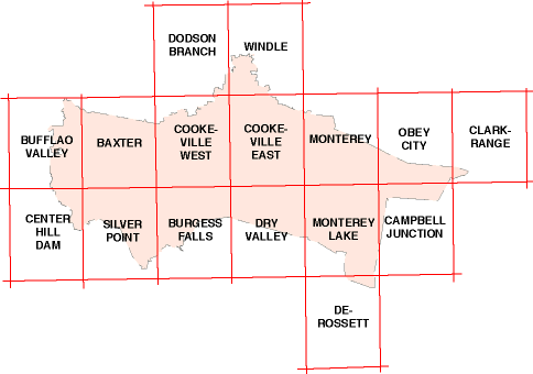
Baxter |
|
|
|
|
Buffalo Valley |
|
|
|
|
Burgess Falls |
|
|
|
|
Campbell Junction |
|
|
|
|
Center Hill Dam |
|
|
|
|
Clarkrange |
|
|
|
|
Cookeville East |
|
|
|
|
Cookeville West |
|
|
|
|
De Rossett |
|
|
|
|
Dodson Branch |
|
|
|
|
Dry Valley |
|
|
|
|
Monterey |
|
|
|
|
Monterey Lake |
|
|
|
|
Obey City |
|
|
|
|
Silver Point |
|
|
|
|
Windle |
|
|
*This is the year the map was last updated.
![]()
Return to the Putnam County Topography and Migration page.
Return to the Putnam County page.
The material for this page was obtained from:
Clay, Jackson, and Putnam Counties,Tennessee, by Charles A. Reeves, Jr. (Charles A. Reeves, Jr.; 10812 Dineen Drive; Knoxville, TN 37922-1809; 1995).
This page last updated by Charles Reeves, Jr. on November 8, 1997.