Area. Extending from 35° to 36° 40' N. Lat., and from 81° 40' to 90° 14' W. Lon., Tennessee has an area of 45,600 square miles; some statements give but 40,000 square miles.
Rivers. The principal river of this state is the Tennessee, which rises in Georgia and Virginia, and has a course of about 1,200 miles; having a rapid descent, it is favorable only to down stream navigation. The Cumberland rises in the Cumberland mountains and is navigable for boats about 500 miles, and for steam-vessels 200 miles.
Face of the Country and Climate. The eastern part of the state is mountainous, being traversed by several chains of the Appalachian mountains; here the soil is excellent and the climate resembles that of the northern states, being best ad apted to the cereal grains. The western part is low, and has a climate suitable for the cultivation of cotton; tobacco and cotton are the staple commodities; hemp and maize are important productions. In general the soil of this state is remarkably fertile , and the climate agreeable and healthy.
Trade. The inhabitants are almost entirely engaged in agriculture, and the trade consists chiefly in the exportation of cotton, tobacco, Indian corn, flour, live stock, and provisions. Saltpetre is also exported.
Mineral Production. Limestone is the basis of a considerable portion of the soil; gypsum, bituminous coal, iron, copperas, and saltpetre, are among the most valuable mineral productions. Some gold has been found, about 7,000 dollars worth having been received at the mint from this state, in 1833. There are some valuable salt springs in Tennessee.
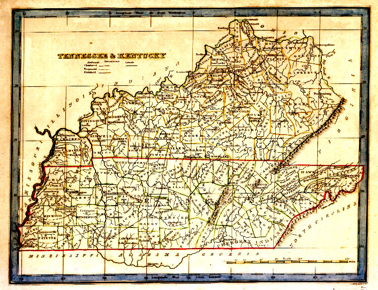
Population and Divisions. The westernmost mountain range, called the Cumberland Mountains, divides the state into the two distinct physical regions above mentioned; Eastern Tennessee, comprising the counties of Campbell, Morgan, Bledsoe, and Marion, and all to the east of them, has an area of about 16,000 square miles, and a population of 196,300 inhabitants, comprising 17,887 slaves; the remainder, or West Tennessee, has a population of 485,606, including 123,716 slaves.
Population in 1800, 105,602, including 13,584 slaves; in 1810, 261,727: in 1820, 420,813; in 1830, 681,904, of whom 4,555 were free blacks, and 141,603 slaves.
Towns. The capital is Nashville, a busy and thriving town on the river Cumberland, with 5,566 inhabitants, among whom 2,012 are slaves. Knoxville, the principal town in East Tennessee, has 3,000 inhabitants. Shelbyville, Murfreesboro, and Memphis, are flourishing villages in West Tennessee, as are also Blountsville, and Greeneville in East Tennessee.
Education. The University of Nashville at Nashville, the East Tennessee college in Knoxville, and the Greeneville college in Greene county, are the principal educational institutions. There is also a theological and literary seminary at M aryville. A school fund for the support of common schools has been distributed among the school commissioners for each county, who are required to distribute the proceeds of the same among the trustees of the school districts, in which schoolhouses have b een erected, in proportion to the number of white children between the ages of 6 and 18 years in each district.
Govenrment. The General Assembly is composed of two houses, a Senate and a House of Representatives, both of which are chosen for the term of two years. The Governor is chosen by the people for a term of two years.
History. This state was originally included in the limits of the North Carolina charter, and was first permanently settled by the whites in the year 1757.
1760. Fort Loudon captured by Cherokees, and the garrison and inhabitants massacred.
1785. A conditional cession of this region having been made by North Carolina to the United States, the inhabitants formed a separate government, under the name of Frankland; this, however, was soon after abolished, and the country again placed under the jurisdiction of [North Carolina].
1790. Tennessee was ceded to the United States by North Carolina and formed into a territory under the name of the Territory South of the Ohio.
1796. The state of Tennessee was admitted into the union.
1834. A convention was held for revising and amending the constitution, which was adopted in 1796.