MAPS OF MADISON COUNTY, TENNESSEE HISTORICAL AND GENEALOGICAL
James H. HannaNote: This work is copyright 1993 by James H. Hanna. We thank Mr. Hanna for allowing us to place these useful maps on the web.
Opening Pages
Acknowledgments
CommentaryEarly Maps
Map 1. Madison County Area (ca. 1820)
Map 2. Madison and Surrounding Counties (1832)
(Rhea Map, includes range and section lines)
Map 3. Resurvey of Madison County Boundary (1842)Beers and Lanagan Map (1877)
Map 4. Index Map Showing Civil Districts
Index of Families by Civil District
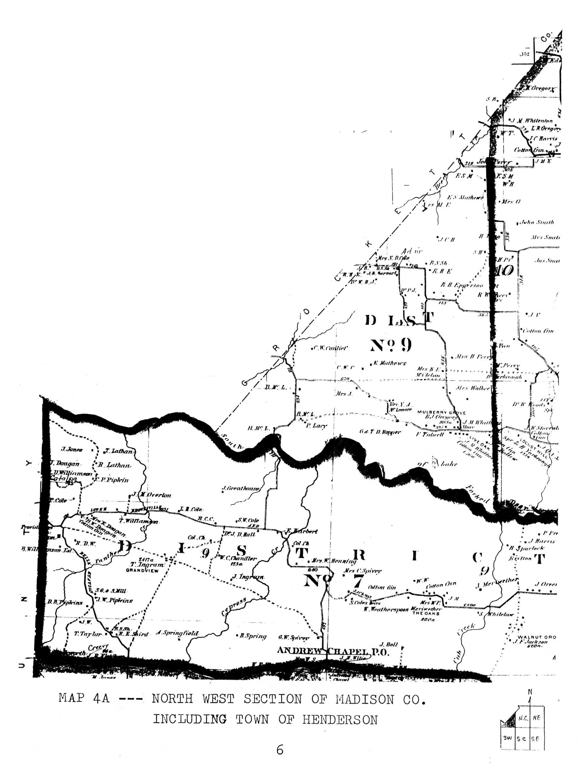
Map 4A. North West Section of Madison Co. (276K)
(scroll down or right to find image)
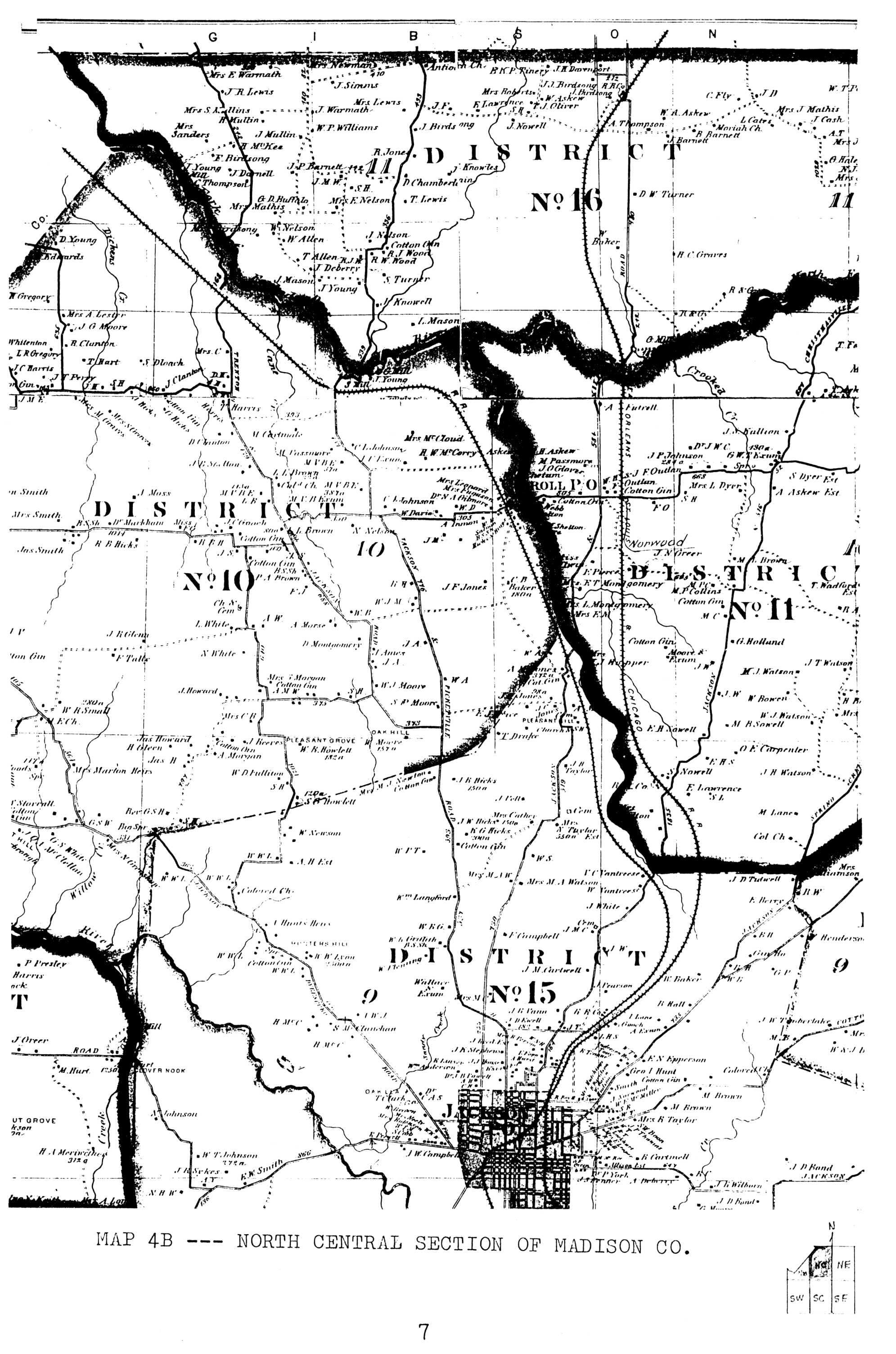
Map 4B. North Central Section of Madison County (601K)
Map 4C. North East Section of Madison County (471K)
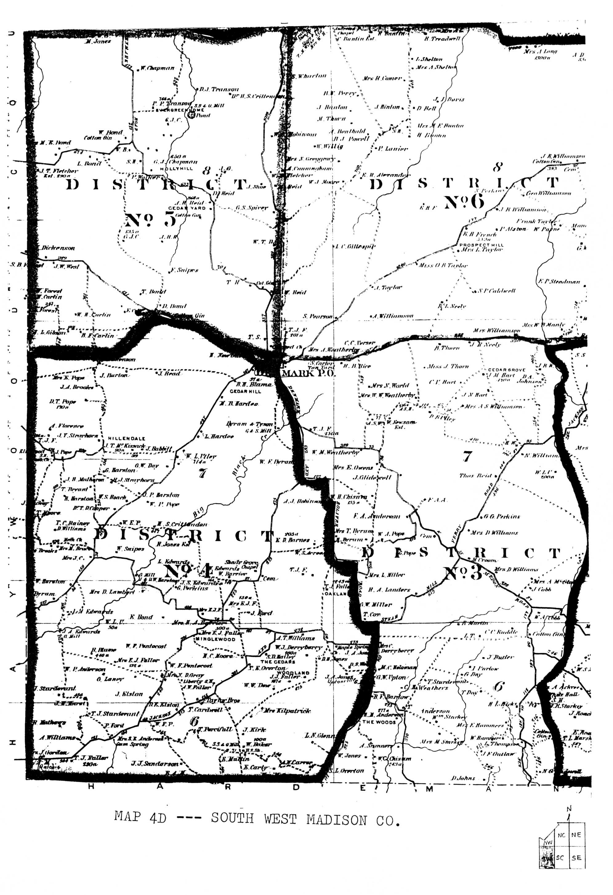
Map 4D. South West Section of Madison Co. (504K)
Map 4E. South Central Section of Madison County (523K)
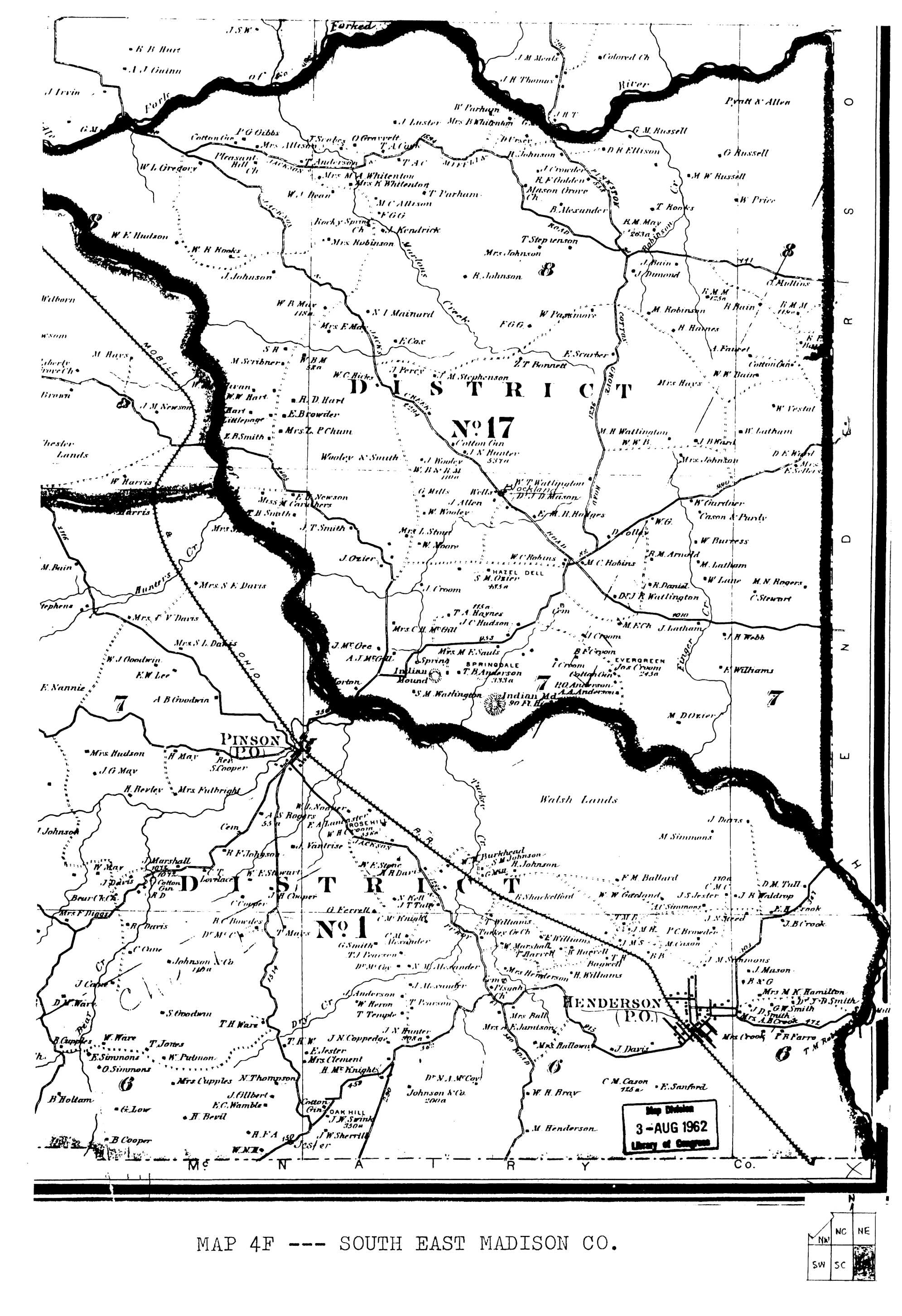
Map 4F. South East Section of Madison County (569K)
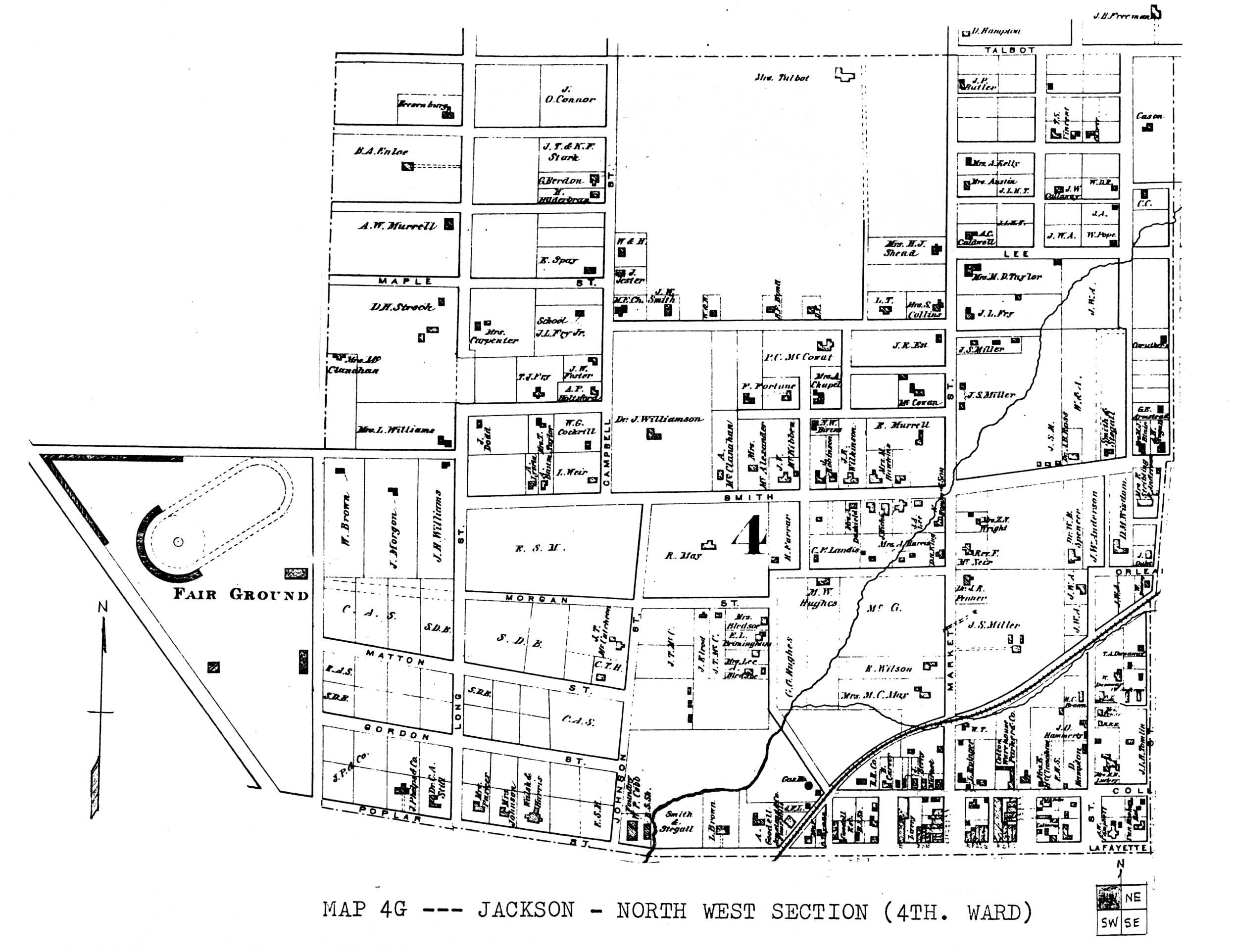
Map 4G. Jackson - North West Section (4th Ward) (375K)
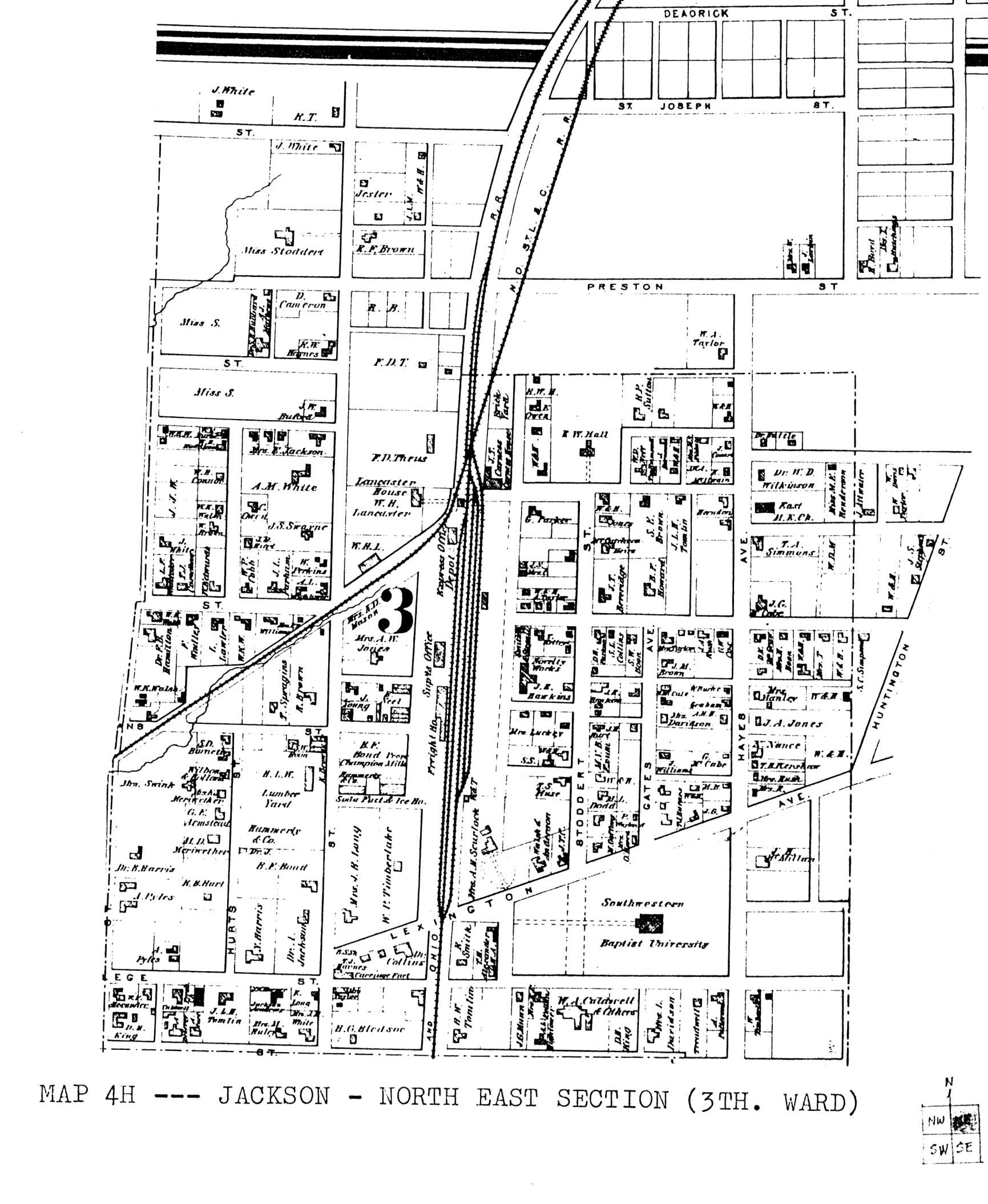
Map 4H. Jackson - North East Section (3rd Ward) (354K)
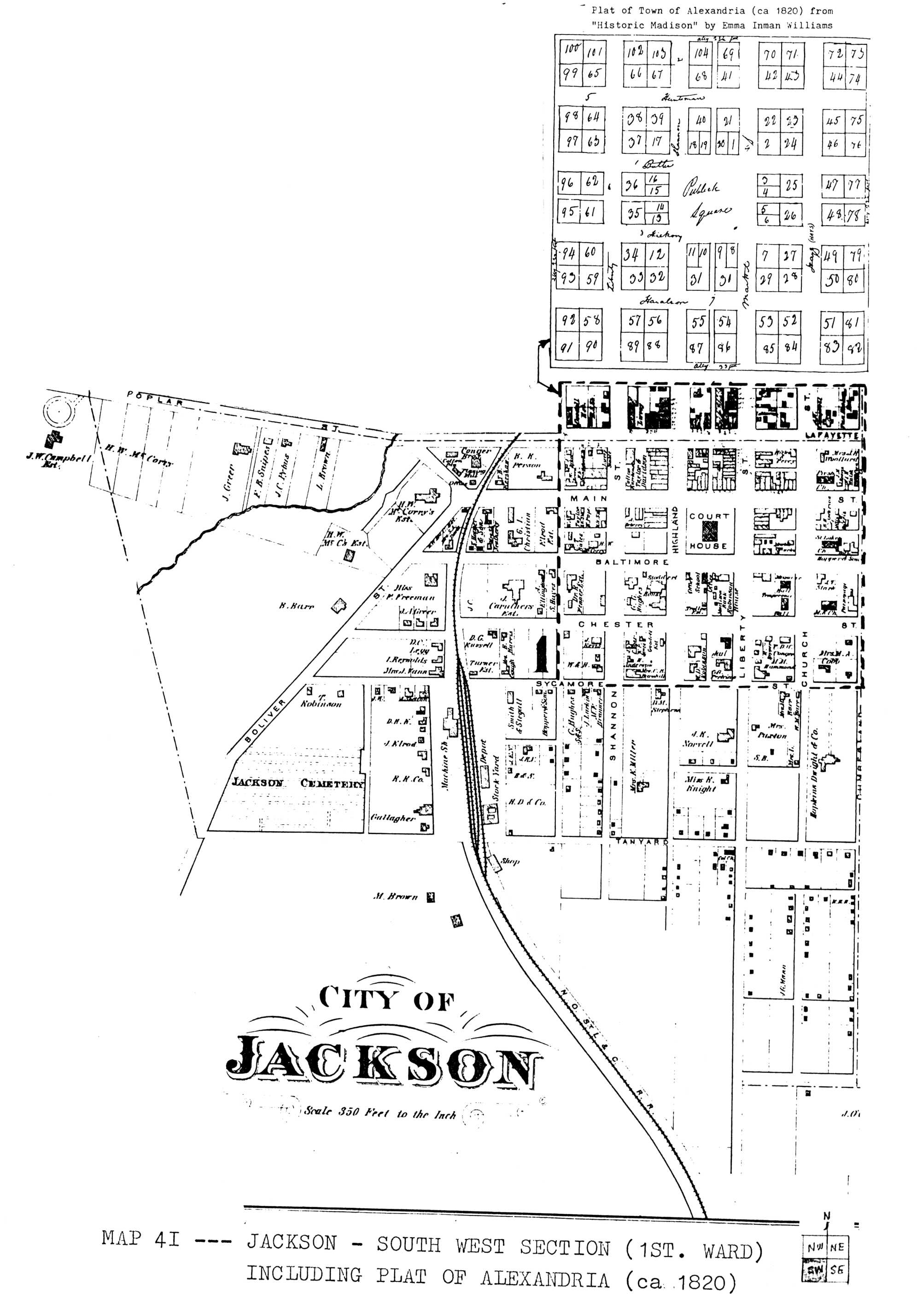
Map 4I. Jackson - South West Section (1st Ward) (395)
(including Plat of Alexandria) (scroll down or right to find image)
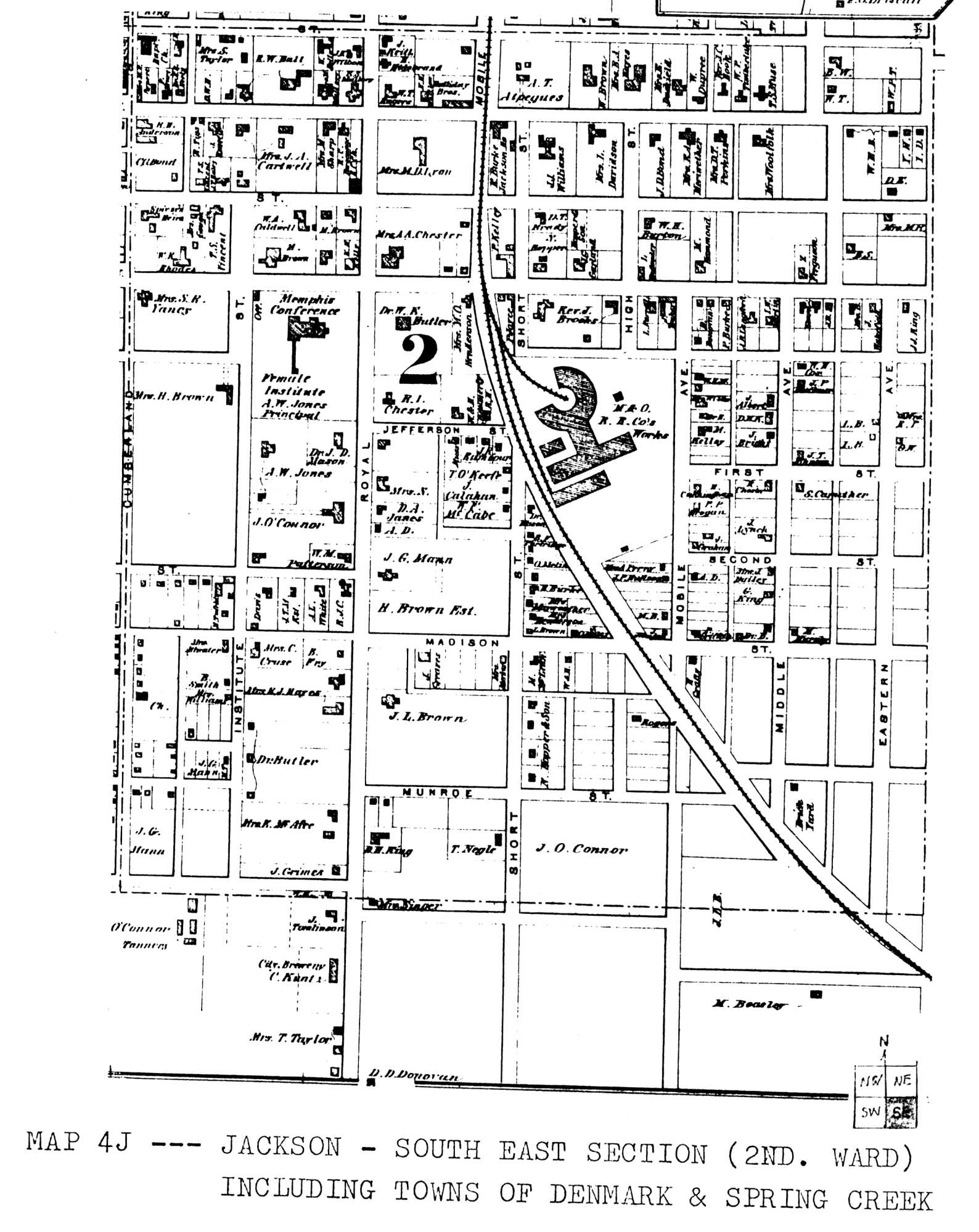
Map 4J. Jackson - South East Section (2nd Ward) (334K)
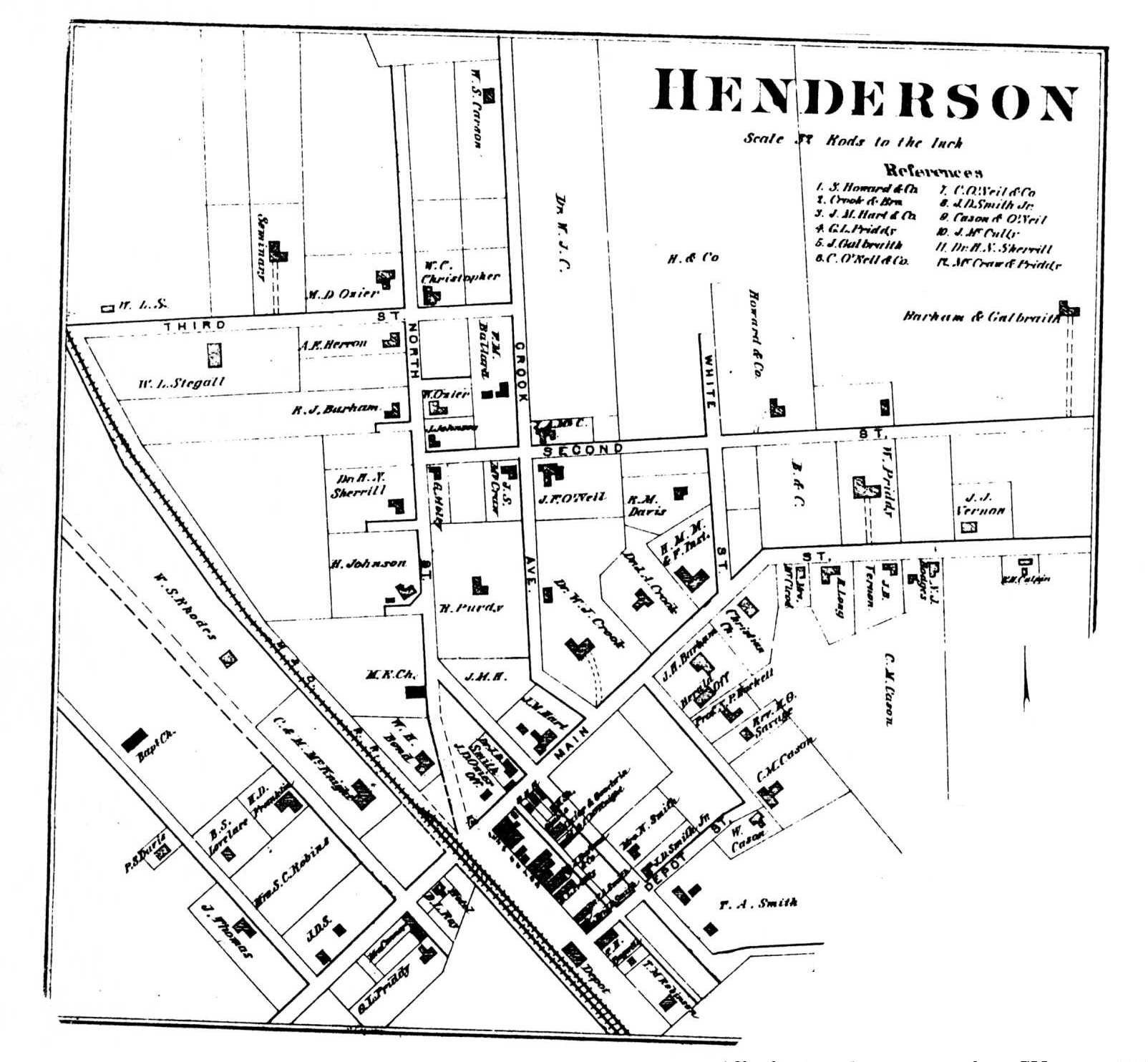
Map 4K. Henderson (201K)
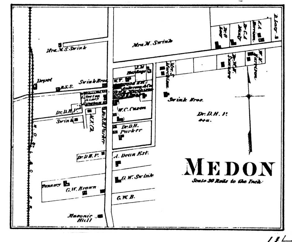
Map 4L. Medon (78K)
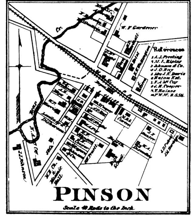
Map 4M. Pinson (76K)
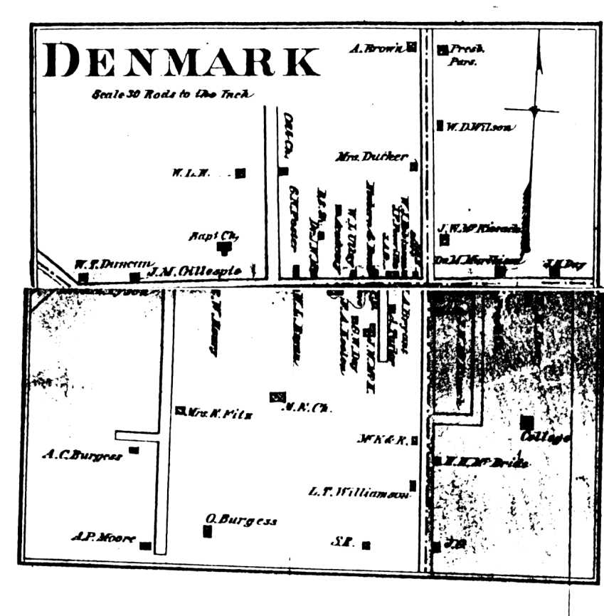
Map 4N. Denmark (82K)
Map 4O. Spring Creek (58K)1932 Madison County Road Map
Map 5. 1931 Madison County Road Map
Map 5A. North West Quadrant
Map 5B. North East Quadrant
Map 5C. South West Quadrant
Map 5D. South East QuadrantStreams
Map 6. Range and Section Lines and Stream LocationsCivil Districts
Map 7. 1840, 1850, 17 Civil Districts
Map 8. 1860, 1870, 18 Civil Districts
Map 9. 1880, 1890, 1900, 17 Civil Districts
Map 10. 1910-1920, 19 Civil Districts
Map 11. 1920, 5 Civil Districts
Map 12. 1930, 9 Civil Districts
Map 13. 1940, 1950, 1960, 10 Civil Districts
Map 14. 1950 Civil Districts, Madison and Adjacent Counties (233K)Corkins Map of Jackson (ca. 1890s)
Map 15. Jackson