Back to County History
AN
OVERVIEW OF UNICOI COUNTY
Unicoi
County is about 1,900 feet above sea level and is surrounded by the
Unaka mountain range which is part of the southern Appalachians. The
Unakas [some of the oldest mountains in the US] split off from the Blue
Ridge Mountains south of Roanoke, Virginia and extend all the way to
northern Georgia. The Unaka range segments itself as follows:
a) Iron Mountains, b) Unakas, c) Bald Mountains, d) Smokies, e) Unicoi
system [which traverses Unicoi Co.]. Nearly 50% of Unicoi
county's land is owned by the Federal Government managed by the
U.S. Forest Service for national
resource management. And because of this, it has greatly curtailed
suburban sprawl and overdevelopment. Therefore, the Unicoi mountain
watershed provides some of the purest drinking water in all of
Tennessee.
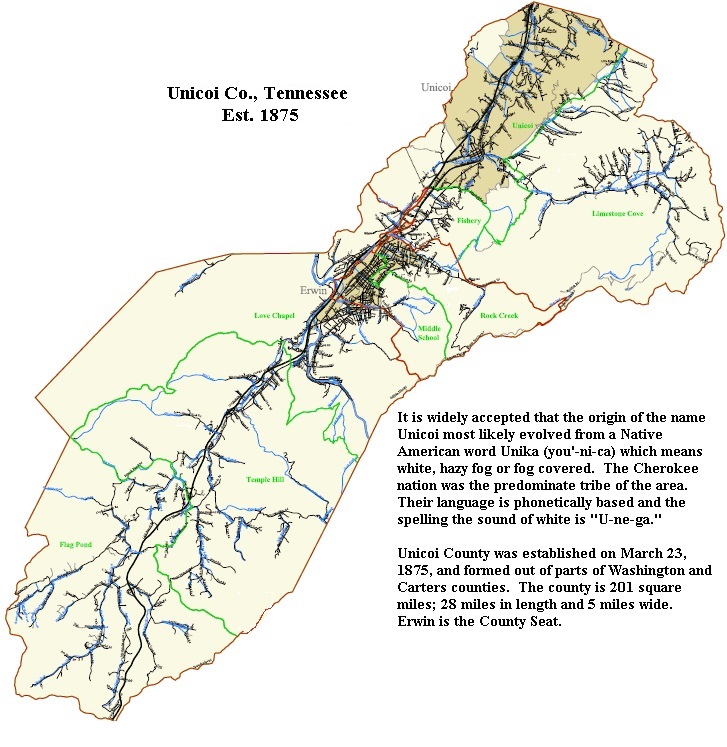
Unicoi
county was formed in 1875 and the following towns were absorbed into
the new jurisdiction as follows:
Villages from Old Carter County: Limestone Cove, Marbleton, Buffalo
Valley.
Villages from Old Washington County: Unicoi, Dry Creek, Erwin (aka
Greasy Cove), Bumpass Cove, Love Station,
Shallow Ford, Temple Hill, Coffee Ridge, Clear Branch and Flag
Pond.
Before
Tennessee became the 16th state in 1796, the area which surrounds
Unicoi/Carter/Washington counties was part of the State of Franklin named
after Benjamin Franklin. The State of
Franklin included territories from both eastern Tennessee and Western,
North Carolina. The area was created shortly after the Revolutionary
War which only lasted for about 4 years. In 1799, there was a
mass campaign to survey the boarders between North Carolina and Tennessee.
Government leaders and private investors summoned surveyors from all
over to not only assess the land's boundaries which separated North
Carolina from Tennessee, but account for the areas natural resources,
wildlife, passages to cross the mountain range to the valleys on either
side and target any hostile local inhabitants. Because of the area
of the State of Franklin, the state lines between NC and TN shifted often,
which explains why some border families who were enumerated in North
Carolina later showed up in Tennessee later.
The
first U.S. Postal route between Abington, Virginia to Knoxville, Tennessee
was established in June 1794. It took the post rider about 4
days each ways to pick up and delivery mail to its destination. Blountville, Rogersville, Greenville, and Jonesboro were the en
route stops. In December of 1832, John Longmire was appointed
as the area's first official postmaster of Unika with a salary of
$300./yr. William Williams was Longmire's successor in March 1836.
In the same year of 1836, the area of Unicoi Co. [Greasy Cove] was
listed as District #2 in Old Washington Co. called "Mire's" District named
after John Longmire. In July 1840, Charles Longmire, a
descendant of John assumed post.