These are some of the words found in old Tennessee land documents and other related records and histories. Most of the words listed below have a wider meaning than given here. It is important to remember that the meaning of some of these words have changed over the years. This work is an attempt to connect with the older meanings.
- Adverse Possession
- This is a legal term, not generally found in land documents. It is a method of acquisition of title to real property by possession for a statutory period under specified conditions.
- Assignee, Assee., Asnee., etc
- The person to whom the right or interest is transferred. Warrants and Certificates, were commonly assigned to others. Entrys and Surveys were occasionally assigned prior to the official granting of title -the land Grant.
- Bank
- Sloped land at the edge of a waterway.
- Barrens, Barrons, Barrans, Barrenz
- Grass lands with few trees. Often referred to as having “Scrubby Oaks” A major feature across parts of Middle Tennessee and into Kentucky. According to George R. Stewart, the pioneers, upon first seeing large areas without trees, mistakenly assumed that the land was poor or infertile, thereby calling the land barren. “The Barrens” of Warren and Coffee counties is actually the gentle divide between the watershed of the Cumberland and the Tennessee Rivers. An 1863 Yankee map refers to that area as “Good Grazing Country. . .Plenty of Water.
- Bearing Tree
- A blazed and marked tree.
- Beech Bottom
- Bottom land with beech trees. These bottoms of beech {and also oak}, were prized by the farmer for he could feed his wild hogs there, on the mast.
- Below
- Down river or down hill .
- Bend
- A curve in a river or stream.
- Block
- The word “black“ poorly written as in “40 poles to a Dogwood & a block, thence . . .” Also the other part, the tree name, like Oak, is omitted.
- Bluff
- High, steep bank or cliff.
- Bottom
- Also called bottom land. The lowest land next to a river. Very fertile but subject to floods - the “June tide”. Remember, that since the early 1800’s, the course of many rivers may have changed within a low wide bottom. Lib Chastain tells of an island mentioned in the her old original deed of the family farm. Now the island is now a peninsula connected to the river bank.
- Branch, Brance
- A creek or stream.
- Call or Calls
- A feature, landmark, or measurement called out in an entry or survey. An example of a call is: “40 poles to a Spanish Oak, thence west . . .” Occasionally, the calls in an entry will not match the actual later survey.
- Canebrake
- An area on the creek or river bottom, overgrown with cane. In the pioneer days, cattle were set lose in the canebrakes and allowed to forage for food, hence the canebrake was much prized. The canebrakes have been greatly over used and in many areas, removed. Still, the bottoms are good place to find the poisonous canebrake (timber) rattlesnake, the copperhead, and cotton mouth or water moccasin. Snakes like to hunt along waterways. Be careful.
- Cadastral Survey
- “Cadastral surveys deal with one of the oldest and most fundamental facets of human society-ownership of land. They are the surveys that create, mark, define, retrace, or reestablish the boundaries and subdivisions of the public lands of the United States. Although cadastral surveys employ scientific methods and precise measurements, they are based upon law and not upon science. Cadastral surveys are the foundation upon which rest title to all land that is now, or was once, part of the Public Domain of the United States.”
Source: U.S. Bureau of Land Managment
- Cave
- Sometimes bad handwriting for “Cove”, however could be a natural cave. Tennessee has many caves. Caves and sinks are often found in the same rock formations, see Sink. The caves have been put to use by Indians, outlaws, saloonkeepers, and politicians, to name a few.
- Caveat, Caveated
- A warning of a legal challenge, a legal notice given to a court or public official to suspend certain proceedings until the complainant is given a hearing. We find the term written on the side of land recordings. Section 16 of the 1806 Act establishing the districts tells us that “If any person shall obtain a survey of land to which another person has a claim,the person having such a claim may enter a caveat to prevent his obtaining a grant, until the claim can be determined. . . .”
- Cedar glade
- An area where Cedars grow but is not productive. Also called Cedar flats.
- Certificate
- An official document issued in payments for debts or upon an applicant meeting certain obligations, such as occupancy and with the payment fees. The Certificate was redeemable in land.
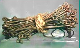
Old Time Surveyor’s Chain
- Chain
- A measuring device usually made of wrought iron links, used to establish the metes and bounds of land during surveys. A chain is sixty six feet in length. The 1806 law required to be used, a chain of two perches of sixteen and one half feet each or a total length of thirty three feet.
I have seen a small brass sixteen and one half foot chain in a little leather case, sort of a pocket model . The chain is also known as a “Gunter’s Chain”. No matter the length of the chain, the recorded “chain” is always sixty six feet, except, we have reports of a strange short chain in East Tennessee. D. Morton Rose, Jr., tells of the “Mountain Chain“, also called a “Blount” or “Sevier County chain” that is thirty three feet in length.
- Chain Carrier, C.C., or S.C.C
- Surveyor’s assistants that handled the measuring chain. Often the chain carrier was a relative of the claimant. The law required that the chain carrier take an oath to the honesty of his work, therefore the chain carrier should have been of legal age. The term “Chain Bearer” is also used.
- Chigger
- While not a survey term, surely the survey party was well acquainted with the chigger. If you are not familiar with this nasty little parasite and plan to explore abandoned farms and overgrown cemeteries in the South, then take Warning ! Ask your Tennessee friends on how to avoid these critters. Panty hose is said to have a deterrent effect. { Gentlemen, take heart. Even the U.S.M.C. will use them.} The chiggers bite. They will cause itching and leave you with quarter size pink polka dots on your legs. The polka dots are not permanent. Incidentally, they can transmit infectious diseases. A chigger is about the size of a pin head . Also, beware of ticks, they can carry Rocky Mountain Spotted Fever and can be deadly.
- Cliff, Clift
- High, steep rock face.
- Commissioner’s Old Line
- See Military Line.
- Compact of 1806
- For the first ten years after statehood, Tennessee was faced with the problem of not having authority over her unoccupied lands. Title was claimed by the United States. In 1806, a compromise agreement was reached with Tennessee, North Carolina, and the United States. This agreement passed by the United States Congress in 1806. The agreement conveyed title to Tennessee, with restrictions. Some restrictions were; the United States was to hold title to the Congressional Reservation, Tennessee would honor future North Carolina grants, Tennessee would reserve land for schools, and Tennessee would not charge less than $2.00 per acre on the sale of any public land. As soon as the Compact of 1806 was law, the Tennessee Assembly at Knoxville established the first six Surveyor’s Districts. Occasionally we see this Compact referred to in old records as the “1806 Act of Congress.”
- Compass
- A simple surveyor’s instrument that has a swinging magnetic needle used to determine the North direction. While the compass is not mentioned in the surveys, we do see the results of the misreading of the compass. We see, in the form of an occasional remark on some surveys and other land records, where it was necessary to make an adjustment or correction of the original survey. The compass needle points to the magnetic North Pole, not to the true North Pole. This causes a compass reading that is not quite true and this small irregularity is known as Magnetic Declination. The surveyor should have adjusted for the declination. Unfortunately not all surveyors did so, and thus causing problems such as over lapping corners, in turn causing complaints and litigation. Be prepared to find tracts that have lines that are not true to the map, and some early maps that are not true to the land. There are indications that when the section and range lines were run in 1807, the surveyors did for the most part take into account magnetic declination. This certainly was not the case for many individual tract surveys.
- Compliment, Complement
- Compliment, Complement ~ That which completes or makes perfect. The last leg of a survey which runs to the beginning and thereby completes the survey.
- Condition
- Same as Conditional Line.
- Conditional Corner
- Where two Conditional Lines converge.
- Conditional LIne
- A boundary line that has been surveyed but not yet been officially granted, or the title has not been made perfect.
- Congressional LIne
- The northern and eastern boundary lines of the Congressional Reservation. From 1806 to 1818 this limited the westward expansion of Tennessee. During the years 1809-11, U. S. Army soldiers from Fort Hampton on the Elk River burned the homes and farms of early settlers that were believed to have settled on Indian land west of Congressional Line.
- Congressional Reservation
- An area in south west Middle Tennessee and the land of West Tennessee, set aside by the U. S. Congress for the use of the Chickasaw Indians. This area was purchased from the Chickasaw people in 1818.
- Continental Line
- In Tennessee land records it means the same as Military Line or boundary of the Military Reservation.
- Corner
- Where two survey lines converge, where the survey changes direction, i.e., North to West etc. Occasionally we see a reference to a neighbor’s “corner“ when what should have been used is the neighbors “line.”
- Cove
- Various definitions. Usually a small narrow valley between to ridges. A secluded mountain valley. Cove also refers to a small bay or inlet. At times, the cove may be flooded at its lower end by seasonally high water.
- Creek
- Stream, branch.
- Cumberland Mountain
- Written in the singular, as if there was one mountain. Refers to the Cumberland Plateau. Not useful as a specific landmark. The Cumberland Plateau was called “the Wilderness” by the pioneers.
- Deputy Surveyor, D.S.
- Assistant district surveyor. Deputy Surveyors did most of the surveys.
- Devisee, Devisees
- The person(s) to whom lands or other real property are given by will or devised.
- Districts:
- Early Judicial Districts in North Carolina’s Western Reserve
- Washington District was formed by North Carolina in 1776 as a judicial district and Court of Common Pleas was held in Jonesboro.
- Mero District was formed by North Carolina in 1788 as a judicial district comprised of three counties: Davidson (formed 1783), Sumner (formed 1787) and Tennessee (formed 1788) (See Map). Mero District was named in honor of Don Estevan Miro, Governor of the Spanish province of Louisiana. (The Miro/Mero spelling variation is correct.)
“The Mero District Superior Court of Law and Equity was established at Nashville in 1788 to hear appeals for the western counties [northern Middle Tennessee].”
Charles A. Sherrill 1998, Tennessee Court System Prior to 1870.
North Carolina’ Administrative Divisions (Land)
- In [1784] a [North Carolina] law was passed authorizing surveys for the claims that had been recorded. For the purpose of these surveys, Tennessee was divided into three districts: (a) Eastern District--Greene County to Cumberland Mountains, (b) Middle District--Cumberland Mountains to Tennessee River, & (c) Western District--Tennessee River to Mississippi River. The borders of Greene County were very vague in many of the claims; some claims on the Mississippi River indicated the land was in Greene County. So, the borders of Eastern District could have been vague and were sometimes considered to be the North Carolina border to Cumberland Mountains. Also, in 1784, the military district was created in North central Tennessee or northern part of Middle District.
A. B. Pruitt, 1998, Land Grants in Tennessee by North Carolina
Three Grand Divisions- Tennessee today is divided into Three Grand Divisions: Eastern, Middle, and Western. The divisions are histroical, geographical, judicial, and pre-statehood. Please visit our Three Grand Divisions of Tennessee page for an indepth look at the divisions.
- Down
- Further from the source. Down hill. You can go down and north at the same time by being on a north flowing river, like the western waters of the Tennessee River.
- Draft, Draught
- A short stream or creek. As seen as “the head drafts of Hooper’s Hollow.” The use of “draft” in this context is very British.
- Drain, Drean, Dreen
- In the earlier surveys; a small natural gully, often seasonal or dry part of the year. Also a small stream. Later, as the farmer worked his land, he could dig new drains. May be seen as “most of the drains of the creek,” referring to small unnamed water courses.
Drain Above Falling River, White County Tennessee
- Eddy
- A variance in the current of a body of water. A whirlpool. Yes, we have seen this used as a landmark corner in surveys.
- Entry
- A claim for land. An early act on the part of a claimant to obtain a grant of a specific tract of land. After the desired tract was “located,” the claimant would pay the required fees, if any, and enter his claim or location with the district land office. This claim is the Entry. After the Entry was made and if the tract appeared to be free of claims, the Deputy Surveyor would do the official survey. It could be many months between Entry and Survey. Land was entered or bought on credit from the State, and one example of a common credit term was 10% downpayment, with 6% interest on the balance. Of course, taxes were always applied as soon as possible.
- Examined & Correctness Ascertained
- A term found on surveys indicating that the Principal Surveyor had reviewed the original survey and found it to be without error.
- Factor and Factory
- Factor: The factor was the operator of a store or trading post. Seen on the old Natchez Trace as Young Factors Stand and Old Factors Stand. There, the factor would trade with the Indians.
Also:
“Factor: 1. In commerce, an agent employed by merchants, residing in other places, to buy and sell, and to negotiate bills of exchange, or to transact other business on their account.
“2. An agent : a substitute.”
(Source: An American Dictionary of the English Language by Noah Webster, LL. D., New York, 1828)
- “Factory. A house or place where factors reside to transact business for their employers.”
(Source: An American Dictionary of the English Language by Noah Webster, LL. D., New York, 1828)
- Ferry
- A scow or flat boat in a fixed location on a river and used to transport, for a fee, people, livestock, and wagons to the opposite side. The ferry was established where a river was too wide and too deep to ford , and if there was enough traffic to justify the venture. On one shore the ferryman usually had a stand or tavern. The ferryman had the reputation of greatly overcharging for his services.
- Field
- Cleared and cultivated land.
- Field Notes
- Permanent detailed records of the survey. Surveyors made notes of their surveys in what is called a Field Book. Additional, they were required to turn in those records to the Land Office. Unfortunately very few were saved.
- Forearm
- A small bay or inlet connecting to a creek or river.
- Ford
- Shallow river crossing. A “waggon ford” would have a good, solid bottom.
- Fork
- Split or branch. A branch of a river. A tree with a split trunk.
- Fountain
- A spring head or source of water.
- Fractional, F.
- An incomplete Range or Section. Sometimes also called “fractional part”.
- Gap
- A sharp break in a single ridge. A valley cutting into a mountain ridge.
- Glade
- An open space in a forest. Also applied to low, open, wet or swampy land.
- Grant
- The official act that passes title from the state to the grantee.
- Grist MIll
- A place where grain is ground. This was a very important place to the farmer. Usually these mills were water powered. Sometimes in the late summer when there was not water in the mill race, a water powered mill would be out of business until the coming of the rains. See “Horse Mill.”
- Grubb
- A stump or root, underbrush. Expect to see things like “three Ceadar Grubbs under a Clift or Rocky face”.
- Guard
- An official member of the survey party in the early days. They protected the others from attacks from Indians and perhaps bears etc. They were paid in land as were the surveyors. We see them mentioned in the certificates.
- Harrican, Hurricane, many spellings
- A hurricane thicket or a dense growth of scrub trees or cane in an area where larger old growth trees have been fallen by a strong wind. A fallen tree could be called a hurricane tree. ~ A different meaning contributed by Charles Majors: “A bearded or hairy cane. This cane grows in dense canebrakes, also called hurricanes.” ~ Expect to see in surveys, etc., descriptions like“ 40 poles to a White Oak in an Old Harricane” See Canebrake. Also see Cane, in the Tree section.
- Head
- Source. A spring head. Head waters. A fountain.
- Heirs
- Under old common law, the person appointed by law to succeed to the estate in case of intestacy. The person who inherits property, whether real or personal. A person who succeeds, by law, to an estate in lands etc., upon the death of his ancestor, by descent and right of relationship.
- Hollow
- A small narrow valley. The gap between two knobs. In colonial times, hollow often referred to a stream, and not the valley. Expect to see: “ . . to a Sugar tree in a Rich hollar.”
- Horse Mill
- Horse powered mill. Sometimes the farmer would supply not only the grain to be milled but also the horse to do the work. Mules or oxen could be used in place of horses. Water powered mills were much favored over the horse mill.
- Hummock, Hammock
- Usually a hill with trees, surrounded by a marsh or swamp. Very rare usage in Tennessee, common usage on the Eastern Seaboard, Deep South, and the Gulf Coast.
- Hunters
- Also called the ’Long Hunters“. The surveying of the Military Reservation required food for the surveyor’s and guards. In those days game hunters accompanied the survey parties and provided them with meat. By law, the hunters were paid in land.
- Improvement
- Usually a cleared field with a cabin, also possibly a barn and out buildings. It was necessary for a claimant to show that he had made certain improvement to the land in order to established his occupant or preference rights.
- Indenture
- A deed between two parties setting forth reciprocal and corresponding grants or obligations to each other. Occasionally, indentures were used in place of wills, and will be found in Deed Books.
- Indian Old Fields
- Small clearings in the forest, or swampy meadows too wet for trees.
- Indian Path, Indian Trail, Wartrace, War Path
- The original Indian trails through the wilderness, created centuries before the coming of the Europeans.
- Island
- A small piece of land in a river. Remember, islands can be washed away and rivers can alter their courses.
- Jacob’s Staff
- A one legged shaft with a compass & sighting device on the top used by the old time surveyors. Easier than a tripod to use in the brush. This term is not found in old surveys but we thought you wanted to know this anyway.
- Knob, Knobb
- A small rounded hill. A “Gobblers Knob” would be a Turkey Hill.
- Legatee
- A person to whom a legacy by will is given. The terms Legatee and Devisee are generally interchangeable.
- Lick
- A mineral or salt deposit used by Buffalo [Bison], deer and other animals. Major animal trails lead to the licks. The area around the licks, where the animals congregated, was sometimes called a “stamping-ground.”
- Line
- The legal edge or limit of a tract of land.
- Locate, Location
- A preliminary survey required to accompany an Entry application.
- Locator, L., Lo., Loc.
- The person that located the boundaries for Entrys.
- Laggoon, Lagoon
- A shallow pondlike body of water connected to a larger body of water, like a river. Sometimes swampy. A backwater.
- Lower
- Further from the source.
- Magnetic Declination
- See compass.
- Marker
- The person that marked the corner trees during the survey.
- Marsh
- Swamp, bog.
- Mathematician
- A term applied to surveyors, occasionally found in early land laws.
- Meanders
- Natural bends in a river etc. The meanders were not always surveyed, thereby causing irregularities in the computation of the acreage of a given tract.
- Metes & Bounds
- The boundaries or limits of a piece of land. Metes means the limit of a surveyed tract, while bounds means the boundaries of the neighbors tract that limit the original tract. “Metes & Bounds” is a term to generically describe the way land was surveyed the original thirteen colonies, Maine, Vermont, West Virginia, Kentucky, Tennessee, and Texas. All are non-Federal public land states and therefore used some version of the “meets & bounds” land descriptions. The other states were Federal public land states and used a Township system of survey and land descriptions. From 1806 on, Tennessee received title to certain parts of her land. Tennessee’s lands therefore were State owned public lands. The Surveyor’s Districts system established by Tennessee in 1806 was an attempt to organize land locations into manageable areas and identifiable tracts. This proved to be generally unsuccessful as the system is not in use today. Nevertheless, Tennessee’s Land Office, through the Surveyor’s District system successfully distributed her vacant lands to the public.
- Military Line
- The boundary of the North Carolina Military Reservation.
- Military Reservation
- A large area of land in north Middle Tennessee set aside in 1782 by North Carolina as the area from which holders of Military Land Warrants could claim land. This reservation became Tennessee’s 1st Surveyor’s District in 1806.
- Military Land Warrent
- Official document issued by North Carolina as payment to her Revolutionary War veterans, redeemable for land in the Military Reservation. A Private was entitled to 640 acres, while on the high side, Major General Nathaniel Greene received 25,000 acres. By the way, General Greene did not take up his grant in the Military Reservation, but rather, south of the Duck River.
- Mill Seat
- Site of a potential water powered mill.
- Mountain
- Natural raised land. Commonly seen, “Base” or “Foot of Mountain”.
- Mountain District
- A district established in 1827 by the State Legislature to dispose of surplus land on the Cumberland Plateau. It was created from parts of four defunct older Surveyor’s Districts.
- Mouth
- Confluence, where two bodies of water flow together.
- Needle
- The compass needle. When the surveyor ran his lines “with the needle,” he would be off true north by 51/2 to 6 degrees or more, depending on the magnetic declinenation for his location, and that explains why so many tracts slant to the north east. See Compass.
- North Carolina Military Reservation
- See Military Reservation.
- Occupant Claim
- Residents of unclaimed public lands were allowed upon application and payment of certain fees, to obtain Certificates that were redeemable in land.
- Old Stone Fort
- Ancient stone walls of Indian origin on the Duck River near Manchester. Coffee Co., Tennessee.
- Orchard
- An area of growing fruit trees. Here we see the imported apple tree. The apple tree was long established on the Eastern Seaboard before being brought to Tennessee.
- Paper Mill
- A mill for the manufacturing of paper.
- Passaway
- A narrow strip of land. Examples: “ ... then East 100 poles to a spanish oak, on the side of a passaway - then North 160 ... ” (Warren County Tennessee 1837 land grant.) “ ... Wilson also granted a 30 foot wide passaway along the line of Thos. Botts.” (deed abstract, Bath Co., KY Deed Book 42, pg. 242)
- Path
- Usually not much more than a foot trail.
- Pike
- A toll road.
- Pitch Tree
- A tree marked with pitch so as to identify it as a corner tree in a survey. Pitch could be pine sap or a black tar.
- Plantation
- Large working farm or estate with resident workers.
- Plat
- A drawing of the survey tract.
- Point,Pint
- A piece of projecting land that juts into a body of water or from high land creating an overlook. Also a point could be a corner in a survey.
- Pointer(s)
- Three man made hack marks on a nearby tree that point to a corner stone or stake of a survey. Many thanks to D. Morton Rose Jr. for this definition.
- Pole
- A survey measurement of 1/4 Chain or sixteen and one half feet. See Rod.
- Pond
- A small standing body of water. Stagnant water, a pool, a swamp.
- Post
- Man made marker to designate the corners of a survey section.
- Post Road
- A road over which mail is carried; a road with stations to provide fresh horses to post riders and mail coaches.
- Powder
- A place where gunpowder is made.
- Prairie, Priarie, Priari, etc
- An area of level or rolling grass land, very often wet land. Prairie is a French word that means meadow and was, according to George R. Stewart, adopted by the pioneers as they moved westward into Kentucky. The pioneers slightly changed the meaning of the French ‘prairie’ to define an area larger than a meadow. A prairie might be a few miles in length. Prairie is often drastically misspelled in the old Tennessee land documents.
- Precipice
- A cliff or overhanging rock face.
- Preemption
- As commonly used in early surveys; a tract granted because of prior occupation to a preemptor. Term has wider legal meaning. See Black’s.
- Preemption Right
- A privilege accorded by the government to the actual settler upon a certain limited portion of public land, to purchase such tract at an established price to the exclusion of other applicants.
- Preemptor
- A preemption claimant. One who has settled on the land subject to pre-emption, with the intention to acquire title to it. Early settlers in the Military Reservation were the Preemptors. “Each head of a family and each single male over the age of twenty-one and living on the land before the first day of June 1780 was entitled to a grant of 640 acres of land.” [Griffey]
- Preference, or Preference Right
- The right to be first. Usually seen when a new survey adjoins an older survey. The line of the new survey would assent to the line of the older survey, or, the original line has senority.
- Principal Surveyor
- Designated by statute as head Surveyor of a District. Also referred to as the “Surveyor General of the _ District”.
- Processioned
- Processioning is the surveying and inspection of boundaries formerly performed by the local authorities in some American colonies, and was replaced by the introduction of the practice of accurate surveying and recording. The term is only rarely see on old Tennessee surveys.
- Prong
- A branch of a stream.
- Puncheon
- A rude wood plank, still rounded on one side, split off of a log. Sometimes used as flooring in log cabins { better than a packed earth floor }. Also used for rough table tops and benches, etc. Seen as Puncheon Creek and Little Puncheon Creek. Perhaps so named because an early settler set up business there and made puncheons.
- Range, R.
- A survey term designating north-south lines that are 6 miles apart in most of Middle Tennessee.
- Register
- The Office of the Register for the 1st, 2nd, and 3rd Surveyor’s Districts, was established at Nashville.
- Ridge
- Long, narrow elevation of land, a long crest of a hill.
- Rise
- A place where an underground creek will reappear. It is said that there was a place on Blue Spring Creek in Coffee County where one could drop a duck into the sink and have it disappear, only to have it reappear out of the rise which was downstream.
- Rod
- A unit of linear measure. Also a measuring device sixteen & one half feet in length and marked in links. Twenty five links to a Rod. A Rod, a Poll & a Perch are all the same length. Of the three, Pole is the common term in old Tennessee.
- Run
- Stream or creek. Can be found much used in Virginia, rare in Tennessee.
- Saplin
- Sapling , a young tree.
- S.C.C.
- Sworn Chain Carrier, see Chain Carrier.
- School Land
- By law each 36 mile Section was allotted a 1 mile square of 640 acres “for the use of the schools for the instruction of the children, forever. .”
- Section
- A survey term designating east-west lines that are 6 miles apart in most of Middle Tennessee. The range & section lines cross to make a square Section. Today we would call this 36 mile square a Township and each of the 1 mile squares, a Section.
- Service Right
- A legal right or entitlement to Military Land Warrants granted to North Carolina’s Revolutionary War veterans.
- Shoal
- Shallows, usually with sand bars, sometimes exposed.
- Sink
- A place where water disappears or sinks underground. Sinks often have no visible outlet . Much of the underlayment of the western Cumberland piedmont { called the Eastern Highland Rim } and the Nashville basin is limestone , a soluble mineral. In such areas , where limestone formations occur, caves, sinks, and sink holes our common . Also see “Rise”
- Six Mile Tree
- A marked tree at the corner of a 36 square mile section. Trees marked with smaller numbers were also used to indicate distances along the boundaries of the sections. Trees along the Military Line and the Congressional Line apparently were both marked with numbers higher than six.
- Sluice, Sluce
- The channels around an island, i.e., “. .crossing the east sluce . .”
- Spring
- The flow of water from the ground, the source or origin . See Spring House .
- Spring Head
- The very beginning of a spring. A good piece of land had a “bold” spring .
- Spring House
- A small, usually stone, structure built over or just below a spring and in the shade and used to keep food cold. If the home was built below the spring house, the water could be brought to the house with wooden water pipes . If the home was up hill from the spring , it would be necessary to carry the water to the house . No pumps back then . The roof of the spring house was handy in keeping debris and dead animals out of the drinking water. Also kept the bears from the larder.
- Spur of the Mountain
- A ridge projecting from the main body of a mountain.
- Square
- A clearing in a wooded area, usually mentioned in conjunction with “his improvement.”
- Stage Road
- A road used by a horse drawn public stagecoach on a regular route.
- Surveyor’s post at survey corners where no tree is available for marking.
- Stand
- The pioneers called them a stand, we would call them a tavern or inn, an ordinary. We would expect to see a stand at a deep river crossing where it was necessary to wait for a ferry, and also along the traces and turnpikes, where ever the travelers would venture. We the have seen one historic reference to a “waggon stand” where whisky was cheaper than at an inn. A stand could also be a grove of trees or plants. You might see in an old deed description; “. . to an Oak in a stand of Hemp.”
- Station
- In the 1780’s, along the Cumberland River, and also in Kentucky and Old Virginia, etc., we see station as a fort or forted settlement, a defendable place. The station was usually walled and included blockhouses. The pioneers lived in the stations for their protection, sometimes for years. In more civilized areas, the station could be a way station or small store. Goodspeed’s “Aborginal Map of Tennessee” shows the location of Middle Tennessee’s early stations. Also see “Post Road”.
- Still
- The equipment used to make whiskey etc.
- Still House
- The house that holds the still. Not all stills are housed, then or now.
- Stump, Stumpe
- The remaining end of a tree after logging, a grubb.
- Suck
- A boiling eddy.
- Survey Abbreviations:
- C.C. = Chain Carrier(s). Could be under legal age.
- C., Clk = Clerk
- D.C., D.Clk. = Deputy Clerk
- D.S. = Deputy Surveyor
- S.C.C. = Sworn Chain Carrier(s). Would have reached legal age.
- P.S. = Principal Surveyor.
- Survey
- The act of physically defining the metes and bounds of a tract or tracts of land.
- Survey, or Certificate of Survey
- The document recording the metes and bounds of the surveyed tract.
- Surveyors’ Districts
- Defined areas established by the State of Tennessee in the year of 1806 and for the purposes of dividing the State into “Convenient Districts“... “Appointment of Principal Surveyors”...“to issue Grants and Perfect Titles”... “and to settle Claims”. Established in 1806, Districts 1, 2, & 3 were in Middle Tennessee, while Districts 4, 5, & 6, and the District south of the French Broad and the Holston were in East Tennessee. In 1818, the Chickasaws sold their rights to their land in what is now West Tennessee. Then Districts 7 & 8, in south west Middle Tennessee, and Districts 9 through 13 in West Tennessee were formed in 1819. Also the Hiwassee District in East Tennessee was formed in 1819. The Mountain District was formed in 1827 from parts of other, then recently closed, District Land Offices. The area covered by this district was generally the Cumberland Plateau. Finally, the Ocoee District of south east East Tennessee was formed in 1836, from the last of the Cherokee’s Tennessee land. The Surveyor’s Districts were to establish a system of section and range lines meant to bring some order to Tennessee’s older “metes and bounds” system. This Surveyor’s Districts system ultimately fell into disuse by 1850, and in 1903 the final Land Office was closed.
- Swamp
- Wet spongy land, a bog.
- Toll Road
- A road where a fee is charged for passage, usually built and operated for a limited period by a private party but under contract with the County or State.
- Tomahawk Claim
- A practice occurring mostly during colonial times and into the 1830s. On the western frontier, the settlers (squatters) would take up land and mark the corners by ringing a tree or trees at each corner of the tract, thereby killing the trees. Much of these Tomahawk Claims occurred on Indian lands, so the squatter would need to wait until the government authorities could coerce the Indians to relinquish title to the land. Then the tomahawk claim could go through a process to become legal, or in land language, to be granted.
- Township
- Normally a thirty six mile square of land {six by six miles}. Used where the land has been surveyed with a rectangular system of survey. All of Tennessee’s Surveyors’ Districts that were located south and west of the Congressional Reservation {7 through 13} used a twenty five mile square townships {five by five miles}. We see that the term “section” was used often in early Tennessee Surveyor’s District surveys, in lieu of the more accepted term “township”.
- Trace
- A well worn path. A horse trail.
- Tract
- A continuous expanse of land, with definable limits.
- True Meridian, Principal Meridian, (Meridian of Longitude)
- The old surveyors would use “true Meridian” to mean a true north-south line running through any specific point. { Note that in 1884 the official principal or prime meridian was established as running through Greenwich England. } The 24 meridians { one for each hour } that stretch around the world, are wider at the equator and converge at the north and south poles. These meridians are never parallel. This would cause a so-called square surveyor’s section to be slightly trapezoidal in shape. It seems that our the early surveyors did not consider this factor. Here is another reason why sections and ranges don’t fit quite right on maps. Incidentally the east-west lines, the Parallels of Latitude, are always parallel. See “Compass”
- Turnpike
- A toll road. In the old days, a turnpike was a barrier set across the road and not removed until the toll was paid.
- Up, Upper
- Closer to the source, or higher in elevation.
- Warrant
- An official document issued in payment for debts and redeemable in land . See Military Land Warrants.
- Waters of....
- On the watershed of a river, however not always on the river itself. Could be on a branch or creek leading to the river. A tract of land on a ridge could be on two different watersheds.
- West Tennessee
- Today, the western most of the three Grand Divisions of the State of Tennessee. However, it was the original term for Middle Tennessee until 1818, when the most western of lands were purchased from the Chickasaw people.
- Withdrawn
- A claimant could recall his claim for land both before and after the survey.
- Wool Carding Mill
- A mill where wool is processed. To “card” is to comb.
COMMON WORDS IN MIDDLE TENNESSEE LAND DOCUMENTS
Fred Smoot, DOG TROT X PRESS, Sausalito, California. (c) 1995 All commercial reproduction rights are reserved. Original version appearing in Warren County Genealogical Association Bulletin, Summer 1995. REVISED VERSION, (c) 1996


Junr = Junior
Senr. & Junr. could apply to both men & women. In pioneer days,
the usage of these terms did not guarantee a parent-child relationship.Return to the Main Tennessee Land Page
Page © TNGenNet Inc 1997-2007 Fred Smoot
Last updated
