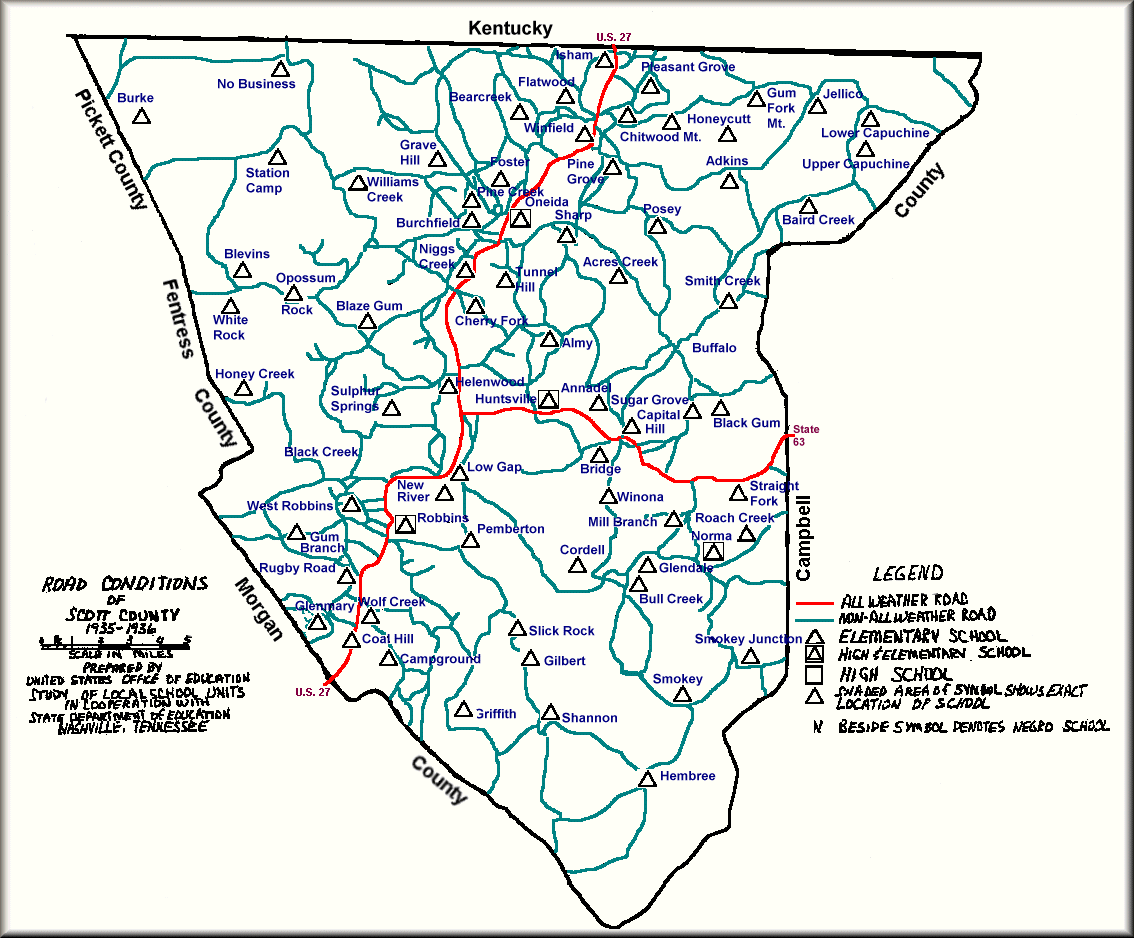
1935-1936 Map
Betty Howard had this map. I scanned it, cleaned it and then added color to it. (I don't believe I made any errors--if there are any, they were unintentional). The name of the map is Road Conditions of Scott County 1935-1936 as prepared by United States Office of Education. The map was prepared as a study of local school units in cooperation with the State Department of Education, Nashville, Tennessee. The truly interesting thing about this map is it identifies communities by many of their old names and also identifies communities that have faded away over the years. Be sure to look at the map legend in the lower right hand corner. The legend says a square identifies a high school, leading one to believe there might be a facility whose sole purpose is to serve as a high school. The only square symbols I could find were those that also contained a triangle--indicating the high school and an elementary school shared the same location. These included schools at Oneida, Huntsville, Norma, and Robbins. The legend also says an "N" denotes a negro school. I could not find a school denoted with this "N". The legend also says "shaded area of symbol shows exact location of school". Again, I could not find a single shaded symbol. Only the original cartographer knows what he meant here.
![]()
![]()


![]() This page was created
by Timothy N. West and is copyrighted by him. All rights reserved.
This page was created
by Timothy N. West and is copyrighted by him. All rights reserved.