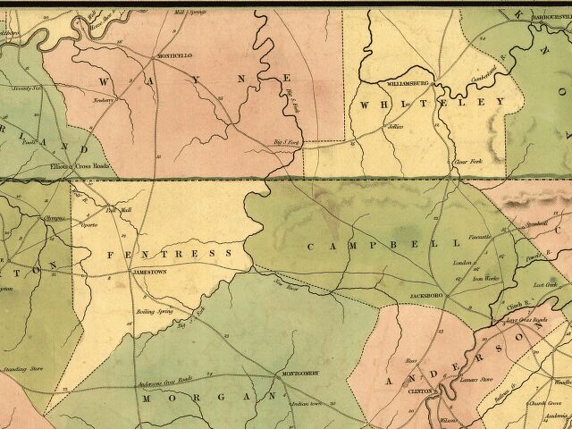
1839 David H. Burr Post Office Map
This cutout of the area soon to become Scott County is from the "Map of Kentucky & Tennessee exhitibing the post offices, post roads, canals, rail roads, &c." By David. H. Burr. (Late topographer to the Post Office.) Geographer to the House of Representatives of the United States.
![]()
![]()


![]() This page was
created by Timothy N. West and is copyrighted by him. All rights reserved.
This page was
created by Timothy N. West and is copyrighted by him. All rights reserved.