MONROE CO. TN
RANGE & TOWNSHIP MAPS
These are large files so be patient. Right click on the files below to download and save,or you can double click to view.
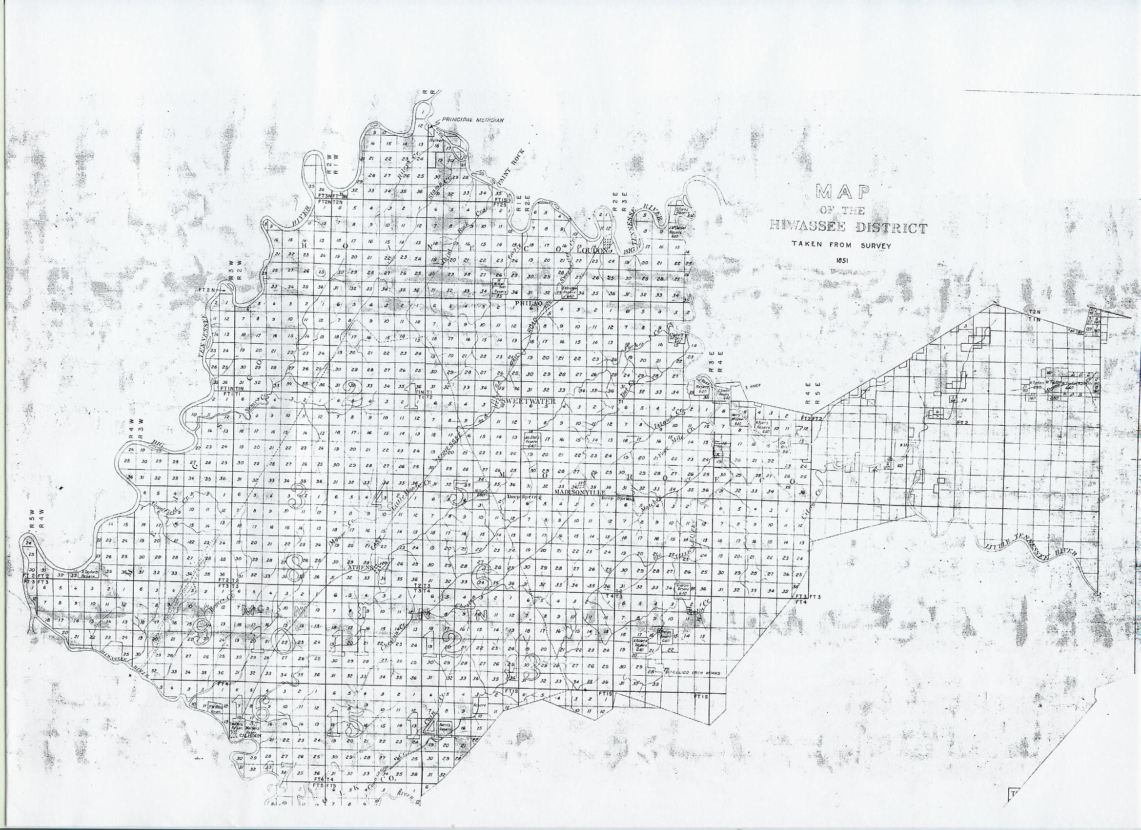
HIWASSEE DISTRICT 1851 MAP -794 kb
Please note the Hiwassee District included parts of surrounding counties at one time.
MONROE CO. TN
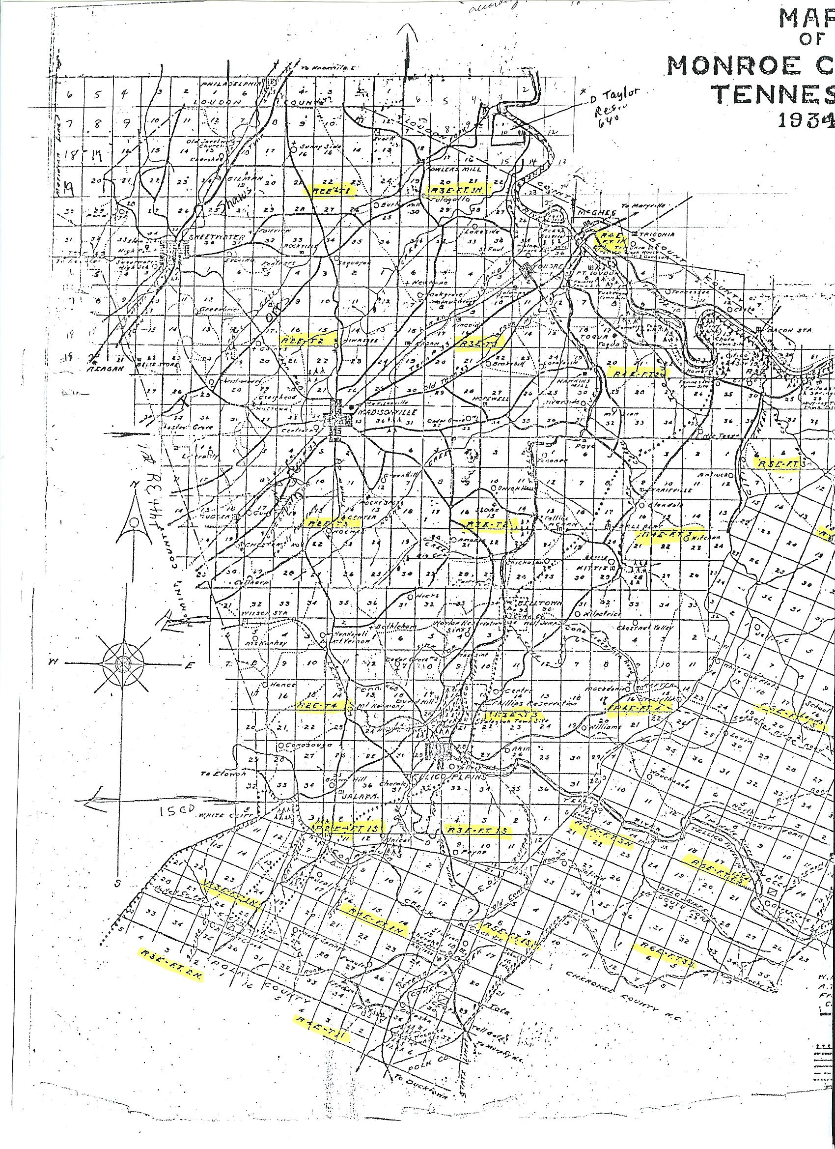
1934 MAP - PART 1 -1.01 mb
MONROE CO. TN
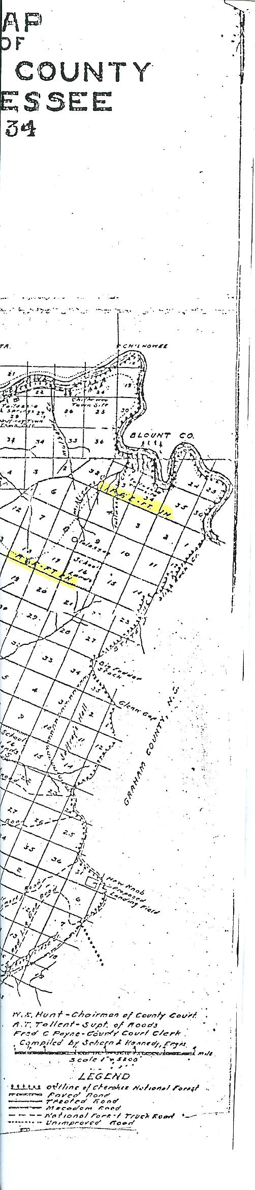
1934 MAP - PART 2 -212 kb
The 1934 is in 2 parts. You'll need to cut and tape them together. I didn't want to shrink it anymore. You can also view this on any of your picture programs and enlarge to see them better.
Quarter section – In U.S. land law, one of the square divisions employed in the survey and
designation of public lands containing 160 acres and measuring Ľ mile on each side.
Township = 36 square miles or 36 sections
Section = 640 acres or one square mile.
A Fractional Township means just that, it’s a fraction of a township.
If you see R3E-T2, it means Range 3 East- Township 2, if it had FT, it means fractional township.
Monroe Co. no longer uses Range and Township in present day deed descriptions.